• Welcome to TechPowerUp Forums, Guest! Please check out our forum guidelines for info related to our community.

Solar System

Moon Jupiter and Earth

APOD20160502.jpg


ASYSM0316_01.jpg


ChdwcbdW0AI_lvD.jpg:large


Sun today

sVPPdZ3.jpg


Faint Aurora

Jason-Brandt-Aurora-03May2016-Jyvaskyla-0047-2_1462232940.jpg


Mars today

1F515249435EFFCQE1P1110R0M1.JPG


NLB_515477131EDR_F0540938NCAM07753M_.JPG


Zadeni Crater, at 128 km wide, is a prominent impact feature in the southern hemisphere of Ceres.

PIA20574.jpg


Although boiling, water does shape Martian terrain

It's well known that water boils at 100°C. But this is only true at sea level, since boiling point depends on atmospheric pressure: the higher the altitude, the thinner the atmosphere, and the lower the boiling point. For instance, at the top of Mount Everest, water boils at 60°C. But on Mars, where the atmosphere is much thinner than on Earth, it can boil at temperatures as low as 0°C. During the Martian summer, when the subsurface water ice begins to melt and emerge at the surface, where the mean temperature reaches 20°C, it immediately starts to boil.

A team of scientists has now shown that even though water that emerges onto the surface of Mars immediately begins to boil, it creates an unstable turbulent flow that can eject sediment and cause dry avalanches.


Last edited:
PIA20576.jpg


PIA20578-1024x768.jpg


New images of Ceres's surface by Dawn

Prague.jpg


Prague from Space by Sentinel-2A satellite

NAC_2016-05-03T00.20.42.746Z_ID10_1397549100_F22.jpg


New image of comet Cherry-Gerry by Rosetta


Data from MESSENGER have been used to create this animation of the first global digital elevation model of Mercury. Surface is colored according to the topography of the surface, with regions with higher elevations colored brown, yellow, and red, and regions with lower elevations shown in blue and purple.

More than 100000 images were used to create the new model.

mercury_craters_0.png


A view of Mercury's northern volcanic plains. In the bottom right portion of the image, the 291 km diameter Mendelssohn impact basin, named after the German composer, appears to have been once nearly filled with lava. Toward the bottom left portion of the image, large wrinkle ridges, formed during lava cooling, are visible. Also in this region, the circular rims of impact craters buried by the lava can be identified. Near the top of the image, the bright orange region shows the location of a volcanic vent.

b5bjYvr.jpg


Sun today
 
Greek Islands from Space

Greek_Islands_seen_from_space.jpg


Aurora

Brian-Larmay-aurora_1462682811.jpg


New Horizons image of Elliot crater, (90 km in diameter) in Cthulhu region, Pluto.


Elliot_crater.jpg


******************************************


mantle700x425.jpg


A team of scientists has found that the dehydration of chlorite is likely to be crucial in explaining the anomalously high electrical conductivity observed in the Earth's mantle (regions between depths of 40 and 100 km). The further increase in electrical conductivity is related to the growth of an interconnected network of highly conductive and chemically impure magnetite mineral phases.

marsgreat_0.jpg


An instrument onboard the Stratospheric Observatory for Infrared Astronomy (SOFIA) detected atomic oxygen ([O I]) in the atmosphere of Mars for the first time since the last observation 40 years ago. These atoms were found in the upper layers of the Martian atmosphere known as the mesosphere.

The_eye_of_Saturn_s_storm.jpg


Sitting at Saturn's south pole is a vortex of monstrous proportions. The dark 'eye' of this feature is some 8000 km across, or ~ 2/3 the diameter of Earth.
Clouds are produced by convection. As warm rising gases reach higher, and therefore colder, layers of the atmosphere, the gases condense and appear as clouds. At the 10 o’clock position, a stream of upwelling gas has created its own smaller vortex inside the larger one. Like earthly hurricanes, the eye of this storm is composed of warmer gas than the surroundings. However, whereas hurricanes are powered by warm water and move across the surface of our planet, this vortex has no liquid ocean at its base and remains fixed to Saturn's south pole.
 
Last edited:
crop.jpg


Researchers have compiled the first global set of observations of flow within the Earth's mantle and found that it's moving much faster than has been predicted.
The Earth's surface bobs up and down like a yo-yo. Over a period of a million years the movement of the mantle can cause the surface to move up and down by hundreds of meters. These movements have a huge influence on the way that the Earth looks today – the circulation causes the formation of mountains, volcanism and other seismic activity in locations that lie in the middle of tectonic plates.


Sunlight over the Ocean

pia20482-1041.jpg


Epimetheus (113 km across), seen here with Saturn in the background, is too small to have sufficient self-gravity to form itself into a round shape, and it has too little internal heat to sustain ongoing geological activity. Thus, its battered shape provides hints about its formation, and the myriad craters across its surface bear testament to the impacts it has suffered over its long history.

jJRtDzV.jpg


Cassini's raw image of Titan

FRB_516094323EDR_F0540938FHAZ00323M_.JPG


Mars today

PIA20579-1024x768.jpg


This image, taken by the framing camera aboard NASA's Dawn spacecraft, shows Ceres' enigmatic mountain Ahuna Mons. The rugged plateau of this feature is sparsely cratered, inferring the mountain was formed in the relatively recent past.
 
Last edited:
A constant outflow of solar material streams out from the Sun. This solar wind is always passing by Earth.

conceptual_animation_of_solar_wind_0.gif


The magnetic field and electric currents in and around Earth generate complex forces that have immeasurable impact on every day life. The field can be thought of as a huge bubble, protecting us from cosmic radiation and charged particles that bombard Earth in solar winds.

Earth_s_protective_shield.jpg


Recent data from ESA's Swarm satellite trio shows clearly that the field has weakened by ~ 3.5% at high latitudes over North America, while it has strengthened ~ 2% over Asia. The region where the field is at its weakest – the South Atlantic Anomaly – has moved steadily westward and weakened further by ~ 2%. In addition, the magnetic north pole is wandering east, towards Asia.

Current_complexity.jpg


*****************

PIA20580.jpg


This image from Ceres features a relatively fresh crater with prominent spurs of compacted material and gullies along its rim. Boulders of a variety of sizes litter the crater's floor and the area around its rim. A smooth blanket of fine, ejected material spreads out radially, muting features in the landscape around the crater.

********


Proba-2_spots_transit_of_Mercury.png


Transit of Mercury seen by Proba-2

********

Early Earth's air weighed less than half of today's atmosphere

The idea that the young Earth had a thicker atmosphere turns out to be wrong. New research from the University of Washington uses bubbles trapped in 2.7 billion-year-old rocks to show that air at that time exerted at most half the pressure of today's atmosphere. Earth 2.7 billion years ago was home only to single-celled microbes, sunlight was about one-fifth weaker.

Other geological evidence clearly shows liquid water on Earth at that time, so the early atmosphere must have contained more heat-trapping greenhouse gases, like methane and carbon dioxide, and less nitrogen. The result also reinforces finding that microbes were pulling nitrogen out of Earth's atmosphere some 3 billion years ago.

********

Cassini's raw image of Saturn

GzCxyLg.jpg


******


Scotland, Northern Ireland and Isle of Man from ISS

Scotland_Northern_Ireland_and_Isle_of_Man.jpg


*******

Sea-level variations from Sentinel-3A

Sea-level_variations_from_Sentinel-3A.jpg
 
c3_strip.png


Sun & Venus

PIA20666.jpg


This view from NASA's Dawn spacecraft shows two medium-sized craters at high northern latitudes on Ceres.

********


2007 OR10: Largest Unnamed World in the Solar System

k2_or10_eder_miles.png


Scientists used NASA's repurposed planet-hunting Kepler space telescope along with the archival data from the infrared Herschel Space Observatory to reveal something surprising: a dwarf planet named 2007 OR10 is significantly larger than previously thought.

2007 OR10 is the largest unnamed body in our Solar System and the 3rd largest of the current roster of about half a dozen dwarf planets.
2007 OR10's diameter is 1535 km [~100 kilometers greater than Makemake, or about one-third smaller than Pluto].
Haumea, has an oblong shape that is wider on its long axis than 2007 OR10, but its overall volume is smaller.
Although 2007 OR10's elliptical orbit brings it nearly as close to the Sun as Neptune, it is currently twice as far from the Sun as Pluto.

The study also found that the object is quite dark and reddish and rotating more slowly than almost any other body orbiting our sun, taking close to 45 hours to complete its daily spin.

According to the new measurements the planet is covered in volatile ices of methane, carbon monoxide and nitrogen.


The apparent movement of 2007 OR10 (indicated with the arrow) among the stars is caused by the changing position of Kepler as it orbits around the Sun. The diffuse light sweeping across is a reflection from the much brighter planet Mars passing nearby.
 
13173526_1000776189999401_5564117112764344623_o.jpg


Operation IceBridge, NASA's airborne survey of polar ice, has returned from the Umanaq B mission along Greenland's western coast. This top-down view from a NOAA P-3 aircraft shows the calving front of Sermeq Kujatdleq glacier.

PIA20667.jpg


This image shows the rim of Occator crater, just east of the area containing the brightest spots on Ceres. The crater rim has collapsed here, leaving structures geologists refer to as terraces. Boulders of various sizes are visible among the terraces.

160509085751_1_900x600.jpg


The Olympus Mons volcano on Mars with a height of 22 km is ~ 2.5 times as high as Mount Everest. Its diameter is 600 km, which is about the distance between Berlin and Munich. Olympus Mons is thus the largest volcano in our Solar System. The volcano shield is shaped in the form of arched terraces and the foot of the otherwise very flat volcano drops steeply. New study indicates that the observed deformations of the volcano are due to gravity, which on Mars is ~ 40 % of the Earth's gravity, and to low frictional resistance in the volcano subsurface.

CiSs4qmVEAEFZ3F.jpg:large


Ch-AdzdVAAAAVe7.jpg:large


Abu-Dhabi & Taipei from ISS

xDM1Sio.jpg


FRB_516376834EDR_F0540938FHAZ00206M_.JPG


Sun & Mars today


New findings - new videos
 

CiaZMA3UoAAiIRt.jpg:large


from ISS

cme_c3_strip.png


A filament of magnetism connecting sunspots AR2542 & AR2543 erupted on May 15th and hurled a CME into space.

potw1615a.jpg


Auxiliary Telescope at the VLT, located at the Paranal Observatory in Chile, looks to be pointing at the greenish emerald glow of the comet 252P/LINEAR high above it.

New_York.jpg


NY as seen from the ISS by ESA astronaut Tim Peake.

CH4 & CO2 increase

PIA20668.jpg


This image from Ceres shows a small, double-impact crater (at bottom) near a larger crater.
The larger structure has a crater floor with roughly the same crater density, and therefore roughly the same age, as the material outside the crater rim.
Within the large crater is a small impact scar with rays of bright material.

 
pia20483-1041.jpg


Filled with kinks, jets, strands and gores, Saturn's F ring has been sculpted by its two neighboring moons Prometheus (seen here) and Pandora. Even more amazing is the fact that the moons remain hard at work reshaping the ring even today.

PIA20669.jpg


Unnamed crater on Ceres

Shahrin-Ahmad-sco-11x30s-iso3200_1463265687_strip.png


Saturn and the red giant star Antares are forming a beautiful triangle with Mars. All three are brightly visible to the naked eye.

DwarfPlanetSystemsCompare1-e1463425512248.gif


Haumea, a dwarf planet on the edge of our Solar system doesn't have the same kind of moons as its well-known cousin Pluto. Haumea has two known satellites, an unusually high spin rate and is also the “parent” of a large family of icy bodies in the outer Solar system that used to be chunks of its surface, but which now orbit the Sun on their own. These unique features are indicative of an ancient collision and make Haumea one of the most interesting objects in the Kuiper Belt.

minxss_cubesats_deployed_from_iss.jpg


MinXSS CubeSat Deployed From ISS to Study Sun's Soft X-Rays

CiiOYZ_WkAAo8Fb.jpg:large


Himalayas from ISS

Cim6EGtW0AAZQCn.jpg:large


ISS

******

Interesting theories:

Earth's atmosphere experienced the first significant, irreversible influx of oxygen as early as 2.33 billion years ago. This period marks the start of the Great Oxygenation Event, which was followed by further increases later in Earth's history. The rise of oxygen in Earth's atmosphere was an inevitable consequence of the formation of continents in the presence of life and plate tectonics.


******


PIA20670.jpg


This image from NASA's Dawn spacecraft shows the western rim of Azacca Crater on Ceres. A smaller impact feature sits on its flank.

******

Europa's Ocean May Have An Earthlike Chemical Balance

A new NASA study modeling conditions in the ocean of Jupiter's moon Europa suggests that the necessary balance of chemical energy for life could exist there, even if the moon lacks volcanic hydrothermal activity. Researchers previously speculated that volcanism is paramount for creating a habitable environment in Europa's ocean. If such activity is not occurring in its rocky interior, the thinking goes, the large flux of oxidants from the surface would make the ocean too acidic, and toxic, for life. But actually, if the rock is cold, it's easier to fracture. This allows for a huge amount of hydrogen to be produced by serpentinization that would balance the oxidants in a ratio comparable to that in Earth's oceans.

******

Voyage_around_Earth.jpg


iss044e045215_lrg.jpg


CisQNRFWgAA-2Xb.jpg:large


CisffyRWUAEd5Dp.jpg:large


New images from ISS


Cut_crater_in_Memnonia_Fossae.jpg


Memnonia Fossae, Mars

*********

Comet_on_11_May_2016_OSIRIS_narrow-angle_camera.jpg


OSIRIS narrow-angle camera image taken on 11 May 2016, when Rosetta was 9.9 km from Comet 67P/Churyumov-Gerasimenko. The scale is 0.16 m/pixel.

*******

nh-stellaroccultationcartoon-use.jpg


This illustration shows how New Horizons' Alice ultraviolet spectrometer instrument “watched” as two bright ultraviolet stars passed behind Pluto and its atmosphere. The light from each star dimmed as it moved through deeper layers of the atmosphere, absorbed by various gases and hazes.

********

nh-kbo-deep_press_anno.gif


Above, the first two of the 20 observations that New Horizons made of 1994 JR1 in April 2016. The Kuiper Belt object is the bright moving dot indicated by the arrow. The dots that do not move are background stars. The moving feature in the top left is an internal camera reflection (a kind of selfie) caused by illumination by a very bright star just outside of LORRI's field of view; it shows the three arms that hold up LORRI's secondary mirror. New Horizons scientists used light curve data – the variations in the brightness of light reflected from the object's surface – to determine JR1's rotation period of 5.4 hours.
 
Uranus May Have a Layer That Keeps Its Glow Dim

5PUMvh9.jpg


Jupiter is hit by an average of 6.5 objects per year that create impacts large enough to be visible from Earth, according to preliminary results from a worldwide campaign by amateur astronomers to observe the giant planet.

******

The_Netherlands_by_night.jpg


The Netherlands by night from ISS

African_mosaic.jpg


African mosaic

*************

1609b_2048x1536.jpg


Bright, frosty polar caps, and clouds above a vivid, rust-colored landscape reveal Mars as a dynamic seasonal planet in this NASA Hubble Space Telescope view taken on May 12, 2016, when Mars was 50 million miles from Earth. The Hubble image reveals details as small as 20 to 30 miles across.

The large, dark region at far right is Syrtis Major Planitia, one of the first features identified on the surface of the planet by seventeenth century observers. Christiaan Huygens used this feature to measure the rotation rate of Mars. (A Martian day is about 24 hours and 37 minutes.) Today we know that Syrtis Major is an ancient, inactive shield volcano. Late-afternoon clouds surround its summit in this view.

A large oval feature to the south of Syrtis Major is the bright Hellas Planitia basin. About 1,100 miles across and nearly five miles deep, it was formed about 3.5 billion years ago by an asteroid impact.

The orange area in the center of the image is Arabia Terra, a vast upland region in northern Mars that covers about 2,800 miles. The landscape is densely cratered and heavily eroded, indicating that it could be among the oldest terrains on the planet. Dried river canyons (too small to be seen here) wind through the region and empty into the large northern lowlands.

South of Arabia Terra, running east to west along the equator, are the long dark features known as Sinus Sabaeus (to the east) and Sinus Meridiani (to the west). These darker regions are covered by dark bedrock and fine-grained sand deposits ground down from ancient lava flows and other volcanic features. These sand grains are coarser and less reflective than the fine dust that gives the brighter regions of Mars their ruddy appearance. Early Mars watchers first mapped these regions.

An extended blanket of clouds can be seen over the southern polar cap. The icy northern polar cap has receded to a comparatively small size because it is now late summer in the northern hemisphere. Hubble photographed a wispy, afternoon, lateral cloud extending for at least 1,000 miles at mid-northern latitudes. Early morning clouds and haze extend along the western limb.


****************


ePMFcV0.jpg


The geologic shape of what were once shorelines through Mars' northern plains convinces scientists that two large meteorites – hitting the planet millions of years apart – triggered a pair of mega-tsunamis. These gigantic waves forever scarred the Martian landscape and yielded evidence of cold, salty oceans conducive to sustaining life.

image_3878e-Mars-Ocean.jpg


Regional view of sections of circum-Chryse highland-lowland boundary region made up of Chryse and Acidalia Planitiae lowlands and Tempe, Xanthe, and Arabia Terrae highlands. The boundary is breached by the planet's largest outflow channels. The red and black lines trace the margins of the two documented tsunami events.

~ 3.4 billion years ago, a big meteorite impact triggered the first tsunami wave. This wave was composed of liquid water. It formed widespread backwash channels to carry the water back to the ocean.

In the millions of years between the two impacts and their associated mega-tsunamis, Mars went through frigid climate change, where water turned to ice.

The ocean level receded from its original shoreline to form a secondary shoreline, because the climate had become significantly colder.

The second tsunami formed rounded lobes of ice. These lobes froze on the land as they reached their maximum extent and the ice never went back to the ocean – which implies the ocean was at least partially frozen at that time.


*********************

nh-frettedterrain_05-19-16-context-r2.jpg


In looking over images of Pluto's Venera Terra region, New Horizons scientists have spotted an expanse of terrain they describe as 'fretted'.
As shown in the enhanced-color image at top, this terrain consists of bright plains divided into polygon-shaped blocks by a network of dark, connected valleys typically reaching 3-4 km wide. Numerous impact craters of up to 25 km in diameter also dot the area, implying the surface formed early in Pluto's history.


********

PIA20671.jpg


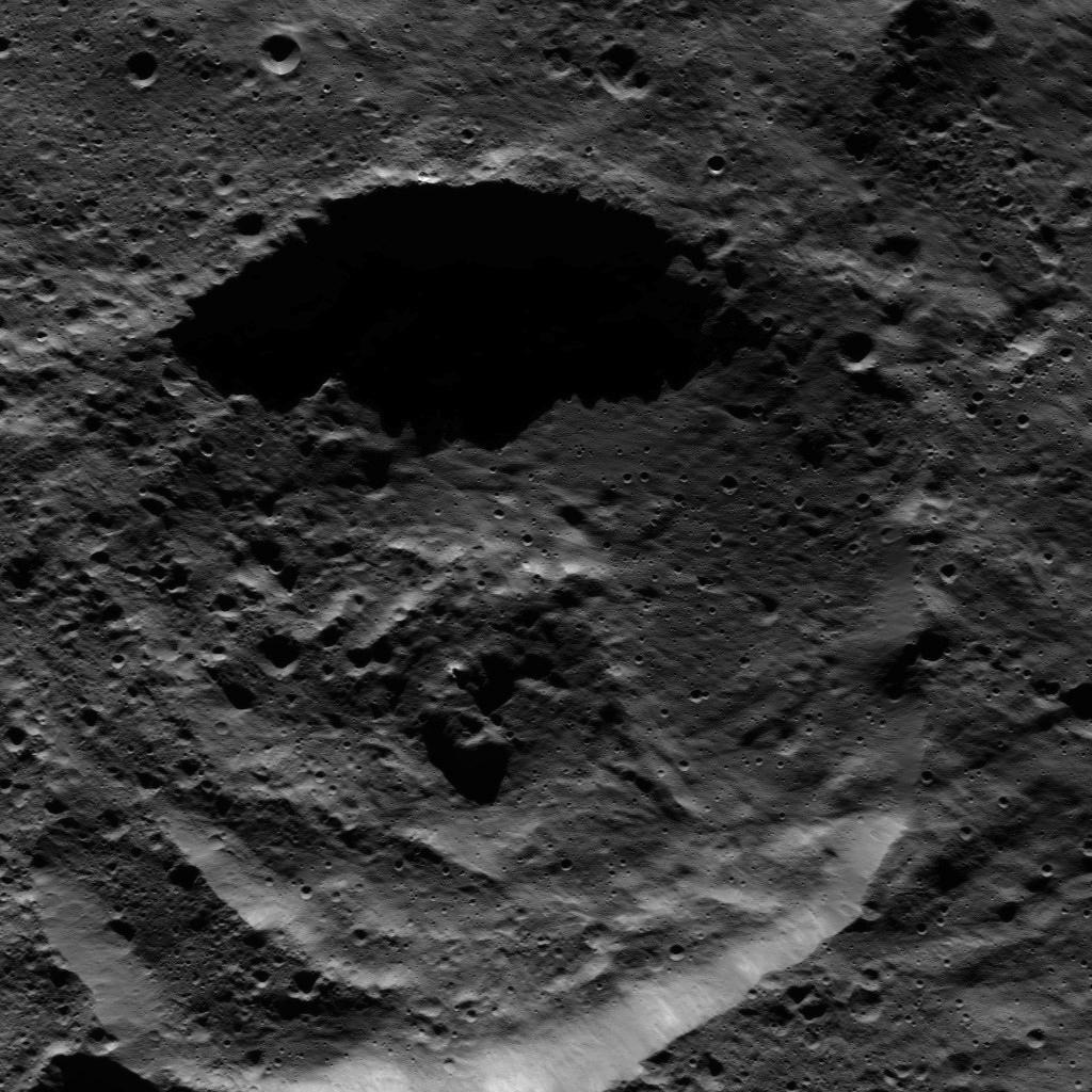
This image from NASA's Dawn spacecraft shows the center of Datan Crater on Ceres. Datan measures ~ 60 km in diameter.

PIA20672.jpg


This image from NASA's Dawn spacecraft shows Attis Crater on Ceres, which measures 22 km in diameter. The long shadows in and around the crater reflect Attis's far-southern location.

******

jp-brahic-MosaAR2546-20160518couleur_1463643767.jpg


Sun's active region today AR2546

*********


The rise and fall of Martian lakes

There is a wealth of evidence, collected over the past few decades, that suggests liquid water was abundant in the early history of Mars. A recent study, using data from several spacecraft operating at Mars, paints a detailed picture of the rise and fall of standing bodies of water in a region of Mars which once hosted one of its largest lakes.

Mars_Old_Lakes2_20160511.jpg


Region of Eridania Lake.


Mars_Express_Atlantis_Chaos.jpg


Perspective view of the Atlantis Chaos basin

Mars_Express_Simois_Colles.png


Perspective view of the Simois Colles basin

 
Last edited:
Comet_on_15_May_2016_NavCam.jpg


Comet Cherry-Gerry close-up by Rosetta

pia20481-1041.jpg


Saturn by Cassini

PIA20674.jpg


PIA20673.jpg


Mondamin & Meanderi craters, Ceres (by Dawn)

FRB_517162538EDR_F0541490FHAZ00323M_.JPG


Mars (image by Curiosity)

Mars_mystery_plume.jpg


Examples of Earth-based observations of the mysterious plume seen on 21 March 2012 (top right) and of Mars Express solar wind observations during March and April 2012 (bottom right).

CjE9J6cWEAEmoS3.jpg:large


CjFfFZcXIAIbts8.jpg:large


CjF-ZUwWkAAVxXl.jpg:large


Alaska, Canada and Moon from ISS (images by Tim Peake)


Watch this movie to see how energy from our young Sun - 4 billion years ago - aided in creating molecules in Earth's atmosphere that allowed it to warm up enough to incubate life.
 
S9JHh8W.jpg


Sun today


CjLG16_UkAMsl77.jpg:large


Casablanca from ISS


NASA's Global Tour of Precipitation in Ultra HD (4K)


ScienceCasts: Red and Golden Planets at Opposition

S01K5DR.png


View of the Chang'e-3 landing site (on the Moon) from the LROC NAC.

 
CjVeSv3WEAAweYM.jpg:large


Juarez, Mexico from ISS


Mars_stack.jpg


In this remarkable movie, the Visual Monitoring Camera (VMC) on Mars Express was used for the first time to image the limb of Mars during most of a complete orbit, showing in good detail the atmosphere seen 'on edge' at the apparent border between the planet's surface and space.

Comet_on_21_May_2016_OSIRIS_narrow-angle_camera.jpg


OSIRIS narrow-angle camera image taken on 21 May 2016, when Rosetta was 7.4 km from Comet 67P/Churyumov–Gerasimenko.

Station_Moon_transit.jpg


ISS & Moon

PIA20675.jpg


PIA20676.jpg


New images of Ceres by Dawn spacecraft

moons_strip2.png


Mars shines 242000 times brighter than Phobos and 741000 times brighter than Deimos. The two moons are easily lost in the glare.

***********************


New model could offer an explanation for cracks like the one on Charon
A new model developed by University of Rochester researchers could offer a new explanation as to how cracks on icy moons, such as Pluto's Charon, formed.

Until now, it was thought that the cracks were the result of geodynamical processes, such as plate tectonics, but the models run by Alice Quillen and her collaborators suggest that a close encounter with another body might have been the cause.

Astronomers have long known that the craters visible on moons were caused by the impact of other bodies, billions of years ago. But for every crash and graze, there would have been many more close encounters. By devising and running a new computer model, Quillen, a professor of physics and astronomy at Rochester, has now shown that the tidal pull exerted by another, similar object could be strong enough to crack the surface of such icy moons. Quillen also thinks that “it might even offer a possible explanation for the crack on Mars, but that's much harder to model.”
 
NASA Radar Finds Ice Age Record in Mars' Polar Cap

mars_polar_deposits_main.jpg


Mars_Triptych.jpg


Scientists using radar data from NASA's Mars Reconnaissance Orbiter (MRO) have found a record of the most recent Martian ice age recorded in the planet's north polar ice cap. The new results agree with previous models that indicate a glacial period ended about 400000 years ago, as well as predictions about how much ice would have been accumulated at the poles since then.

pia20029_figa_labeled.jpg


On Earth, ice ages take hold when the polar regions and high latitudes become cooler than average for thousands of years, causing glaciers to grow toward the mid-latitudes. In contrast, the Martian variety occurs when - as a result of the planet's increased tilt - its poles become warmer than lower latitudes. During these periods, the polar caps retreat and water vapor migrates toward the equator, forming ground ice and glaciers at mid-latitudes. As the warm polar period ends, polar ice begins accumulating again, while ice is lost from mid-latitudes.


****************

Chile_s_salt_flat.jpg


The Sentinel-2A satellite takes us to the diverse landscape of the eastern Atacama desert in South America.


**********

PIA20677.jpg


This picture from NASA's Dawn spacecraft shows craters near the equator of Ceres. Faint patches and streaks of bright material can be seen in various parts of the scene. The two largest craters have streaks of material on their walls.

*******

Latest videos:


system91l-goes-52716.jpg


NOAA's GOES-East satellite captured this daytime view of developing System 91L between the Bahamas and Bermuda on Friday, May 27


view_of_a_boulder-rich_surface_deposited_by_the_older_tsunami.jpg


View of a boulder-rich surface deposited by the older tsunami on Mars. These were then eroded by channels produced as the tsunami water returned to the ocean elevation level (white arrow shows flow return direction). Yellow bars are 10 m.

color_coded_digital_elevation_model_showing_the_two_proposed_shoreline_levels_of_a_mars_ocean_from_3.4_billion_years_ago.jpg


Left: Color-coded digital elevation model of the study area showing the two proposed shoreline levels of an early Mars ocean that existed ~ 3.4 billion years ago. Right: Areas covered by the documented tsunami events extending from these shorelines.

********

PIA20678.jpg


This picture shows a portion of the northeastern rim of Yalode Crater, one of the largest impact features on Ceres. Yalode has a diameter of 260 km. A set of narrow, roughly parallel fractures can be seen at top center.

*********

TXvBrqF.jpg


Sun today

********

Rosetta_s_comet_contains_ingredients_for_life.jpg


The Rosina-DFMS instrument detected ingredients considered important for life as we know it on Earth, in the coma of Comet 67P/Churyumov-Gerasimenko.

One important detection was that of the simple amino acid glycine (top, C2H5NO2), a biologically important organic compound commonly found in proteins. Phosphorus was also detected (bottom, P), a key element in all living organisms. It's found in the backbone of DNA and RNA, in cell membranes, and in adenosine triphosphate (ATP), which transports chemical energy within cells for metabolism. The multitude of organic molecules identified by Rosetta confirms the idea that comets have the potential to deliver key molecules for prebiotic chemistry on Earth.

******

Cjdg7ZUWEAApW_r.jpg:large


Scandinavia from ISS

********


Dramatic Footage Shows Mount Etna's Eruptions
 
Last edited:
ch_strip.png


Sun today


A 1-Minute 'Rock Avalanche' 4800 Years Ago Was Instrumental In Forming Utah's Zion National Park

Deep_blue_Red_Sea_reefs.jpg


Red Sea from Copernicus Sentinel

violinglacier.jpg


Greenland, photo by NASA's IceBridge

1-astronomerso.jpg


Asteroid Phaethon is suspected to be a member of the Pallas family of asteroids. It approaches the Sun more closely than any other named asteroid - its perihelion is only 0.14 AU (~ 21 million km).


As part of ESA's proposed Asteroid Impact Mission would come the Agency's next landing on a small body since Rosetta's Philae lander reached 67P/Churyumov-Gerasimenko in 2014. In 2022 the Mascot-2 microlander would be deployed from the main AIM spacecraft to touch down on the approximately 170-m diameter Didymoon, in orbit around the larger 700-m diameter Didymos asteroid.


Scientists say Kepler-62f [a planet roughly 1200 ly away from Earth] might be suited for habitability
 

Comet_on_28_May_2016_OSIRIS_narrow-angle_camera.jpg


Comet_on_19_May_2016_NavCam.jpg


Cherry-Gerry

Space_Station_Mercury.jpg


Mercury, ISS and Sun

Fort_McMurray_fires.gif


On 25 May 2016, the Sentinel-2A satellite captured these images of smoke and fires raging north of the Athabasca River near Fort McMurray in Canada's Alberta province.


Not Solar system related but I put it here :p:

UBC astronomy student discovers 4 exoplanets


Chile's salt flat from space


ESA's active debris removal mission: e.Deorbit. Sounds pretty cool! :cool:

Philip-Smith-BEAM-Module-and-ISS-Ac-Philip-Smith_1464575091.png


ISS & BEAM


Astronomers show that it's highly likely that the so-called Planet IX is an exoplanet. This would make it the first exoplanet to be discovered inside our own solar system. The theory is that our Sun, in its youth some 4.5 billion years ago, stole Planet IX from its original star.

Sun is the thief! :eek:
 
On June 7th, Venus will be at superior conjunction - a wonderful sight if only we could see it. The entire hemisphere facing Earth will be illuminated. Venus's acid-laced clouds are terrific reflectors and full Venus would surely be visible in broad daylight, an intense pinprick of light in the blue sky.

c3_strip.png


*******************

Gwendolyn Eadie is getting closer to an accurate answer to a question that has defined her early career in astrophysics: what is the mass of the Milky Way?

The short answer, so far, is 7x10^11 solar masses. In terms that are easier to comprehend, that's about the mass of our Sun, multiplied by 700 billion. The Sun, for the record, has a mass of 2 nonillion (that's 2 followed by 30 zeroes) kg, or 330 000 times the mass of Earth.

"And our galaxy isn't even the biggest galaxy," Eadie says.

******************

PIA20679.jpg


This picture from NASA's Dawn spacecraft shows terrain on Ceres in which the rim of a more recent impact crater, at center, has partially collapsed into its adjacent neighbor, just below. Boulders are visible in and around the younger, smaller crater.

***************


Hawaii’s Kilauea volcano erupts sending lava flows from one of its cones


*************

pia18369-1041.jpg


Saturn's moons Janus and Mimas in this view from NASA's Cassini spacecraft.


***********

iss045e056257_lrg.jpg


An astronaut aboard the ISS used a powerful lens to photograph these three reefs in Australia's Great Barrier Reef. The photo area spans about 15 km of the 2300-km reef system. Reefs are easy to spot from space because the iridescent blues of shallow lagoons contrast sharply with the dark blues of deep water.

************

NLB_517960514EDR_F0542262NCAM00285M_.JPG


Mars today
 
Just what sustains Earth’s magnetic field anyway?

Earth accreted from rocky material that surrounded our Sun in its youth, and over time the most-dense stuff, iron, sank inward, creating the layers that we know exist today - core, mantle, and crust. Currently, the inner core is solid iron, with some other materials that were dragged along down during this layering process. The outer core is a liquid iron alloy, and its motion gives rise to the magnetic field.

Scientists found that thermal conductivity in Earth's core is 18-44 W/(m·K). This translates to predictions that the energy necessary to sustain the geodynamo has been available since very early in the history of Earth.


****************

A new study led by Purdue University and the University of Colorado Boulder indicates the bodies of some periodic comets – objects that orbit the Sun in < 200 years – may regularly split in two, then reunite down the road. In fact, this may be a repeating process fundamental to comet evolution. Scientists hypothesized that the repeated break-up and make-up of bilobed comets may have caused them to erode too much to have survived their journeys into the inner solar system 4 billion years ago when it was a shooting gallery of asteroids, moons and protoplanets.

***************

nh-mckinnon_etal_nature_cover_trimmed.jpg


Scientists from NASA's New Horizons mission used state-of-the-art computer simulations to show that the surface of Pluto's informally named Sputnik Planum is covered with churning ice "cells" that are geologically young and turning over due to a process called convection. Scientists believe the pattern of these cells stems from the slow thermal convection of the nitrogen-dominated ices that fill Sputnik Planum. A reservoir that's likely several miles deep in some places, the solid nitrogen is warmed by Pluto's modest internal heat, becomes buoyant and rises up in great blobs – like a lava lamp – before cooling off and sinking again to renew the cycle.

Ridges that mark where cooled nitrogen ice sinks back down can be pinched off and abandoned, resulting in Y- or X-shaped features in junctions where 3 or 4 convection cells once met. These convective surface motions average only a few cm a year – about as fast as your fingernails grow – which means cells recycle their surfaces every 500 000 years or so. This activity probably helps support Pluto's atmosphere by continually refreshing the surface of 'the heart'.

********************

La_Reunion_Island_via_laser.jpg


Sentinel-1A radar satellite test image taken on 26 May 2016, recorded and relayed to Earth by EDRS-A on 31 May 2016 via laser. The image covers the island of La Reunion and surrounding waters, and was acquired in 'Stripmap' mode. A false-color composite based on the radar's two polarization channels.

**********

PIA20680.jpg


This Ceres scene captured by NASA's Dawn spacecraft shows an ancient crater wall that has been disrupted, possibly by a landslide.

*********

1F517827786EFFCQG7P1110L0M1.JPG


hD5zwl2.jpg


Mars & Sun today
 
Mike-Lerch-june0216b5438_1464913315.jpg


ASTEROID EXPLODES OVER ARIZONA

Southern_Maine.jpg


The Sentinel-2A satellite takes us over southern Maine and part of New Hampshire in the northeast United States.

Cj-ujvqXAAUCzfy.jpg


L.A. from ISS


America's First Lunar Surveyor: 50 Years Later

PIA20681.jpg


This picture from NASA's Dawn spacecraft shows a crater in the northern hemisphere of Ceres with spurs of compacted material on its walls.


'Does Jupiter Have a Core?' with Bill Nye


Elon Musk: Humans May Just Be Characters In Another Civilization's Video Game

darksideimage_unann.png


Pluto's 'Twilight Zone'


Universe Expanding Faster Than Previously Thought
 
Last edited:

Astronomers using the upgraded Karl G. Jansky Very Large Array in New Mexico have produced the most detailed radio map yet of the atmosphere of Jupiter, revealing the massive movement of ammonia gas that underlies the colorful bands, spots and whirling clouds visible to the naked eye. The radio map shows ammonia-rich gases rising into and forming the upper cloud layers: an ammonium hydrosulfide cloud at a temperature near 200 K and an ammonia-ice cloud in the approximately 160 K cold air.

jupitersmeared.jpg

A radio image of Jupiter from the VLA at three wavelengths: 2 cm in blue, 3 cm in gold, and 6 cm in red. The pink glow surrounding the planet is synchrotron radiation produced by spiraling electrons trapped in Jupiter's magnetic field. Banded details on the planet's disk probe depths of 30-90 km below the clouds.

**************

9-scientistsre.jpg


Craters on the surface of the asteroid Lutetia


******************

CkD_J41WsAAkN62.jpg:large


Swirling night clouds off the coast of Africa from ISS

************

PIA20682.jpg


This picture captured by NASA's Dawn spacecraft shows a crater that lies just north of Occator Crater on Ceres.

****************

solarwind.jpg


This pictures shows how the solar wind interacts with comet 67P.

*************

Asteroid Collision Simulation (video)


************

nh-image2.jpg


LORRI image of Pluto taken July 12, 2015, 2 days before closest approach.

nh-image3.jpg


LORRI images of Pluto's small moon Kerberos

nh-image4.jpg

At left is one of more than 200 LORRI images obtained to image the dark side of Charon by 'Plutoshine'. At right, after all of the images are combined and corrected for the scattered light - Charon's crescent and nightside are revealed!

****************


Brian Greene Explains The Most Powerful Explosions In The Universe
 
evis2m8.jpg


Sun was quite active a couple of days ago.

A relatively small but growing active region illustrated the fierce battle of magnetic fields as they connect and reconnect and struggle over a little more than one day (May 30-31, 2016). As we observe it close-up in extreme UV light, we can see the magnetic field lines shift and change very quickly. The field lines are visible because charged particles, visible in this wavelength, are spinning along the magnetic arcs reaching between areas of opposite polarities. The area was the source of numerous small eruptions, including one or two solar flares.

blanksun.jpg


But today it's blank. Solar minimum is Coming.

ESP_043651_1590.jpg


An inverted crater on Mars


CkM-o95UUAItyW4.jpg:large


France from ISS
 
Taichi-Nakamura-traceoflight_MG_5825_1465261942.jpg


Beautiful aurorae

27420333805_6fd1876a46_o.jpg


Expedition 47 Flight Engineer Tim Peake of the ESA photographed rare, high-altitude noctilucent clouds from the ISS on May 29, 2016.

triple-conjunction-2012.jpg


Triple Play: Moon, Venus & Jupiter

pia20484-1041.jpg


Distant Titan, its northern hemisphere drenched in the sunlight of late spring, hangs above Saturn's rings. What might at first glance look like a gap between the rings and the planet is actually Saturn's shadow. During most of Saturn's long year, the projection of the planet's shadow extends well beyond the edge of the A ring. But, with summer solstice fast approaching, the Sun is now higher in Saturn's sky and most of Saturn's A ring is completely shadow-free.


NASA Studies Details of a Greening Arctic


NOAA Team Helps NASA's Operation IceBridge Tackle Arctic Spring

PIA20683.jpg


This picture captured by NASA's Dawn spacecraft shows a portion of the northern rim of Occator Crater, which measures 92 km across and 4 km deep.
 
Tiny sunspot, Moon and Jupiter

newspot_strip.png


David-Blanchard-20160606_2057_DBP_1612_1465352866.jpg


Charles-Chiofar-Jupiter_1465319169.jpg


Concordia sits on a plateau 3.2 km above sea level. A place of extremes, temperatures can drop to –80°C in the winter, and the Sun does not rise above the horizon in the winter, forcing the crew to live in isolation without sunlight for four months of the year.

Step_to_the_stars.jpg


New photos taken by ISS astronauts

CkXc6SgXEAEEXSK.jpg:large


CkCgk2cUoAAQQzc.jpg:large


CkCx7W1VAAAt5jt.jpg:large


CkWZ92zXIAAlcaw.jpg:large


******************


This picture shows a crater in the southern hemisphere of Ceres with a complex of central peaks.

PIA20684.jpg


*******

It's late winter in the southern hemisphere of Mars, and dunes are just getting enough sunlight to start defrosting their seasonal cover of CO2. Spots form where pressurized CO2 gas escapes to the surface.

 
Back
Top